1 October 2026
Road Weather Stations and Road Weather Information Systems Explained
Key takeaways
- A Road Weather Information System (RWIS) combines front-end weather stations, satellite data and forecasting models to generate traffic warnings before conditions become dangerous.
- Low visibility contributes to around 25% of expressway accidents, and fog-related accident rates can run roughly ten times higher than normal.
- Wind speeds above 15 m/s are linked to a sharp rise in accident risk, and gusts around 22 m/s combined with rain can significantly reduce vehicle control.
- Station spacing along a route depends on fog risk: 20 to 50 km in fog-prone areas, 10 to 15 km in seasonal fog zones, and 3 to 5 km in mountainous fog corridors.
What a road weather station measures
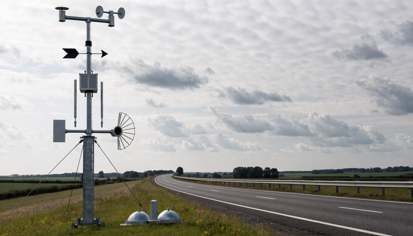
A road weather station is a purpose-built instrument cluster for the transport sector. At minimum it combines temperature and humidity, wind direction and wind speed, air pressure, and rainfall sensors. Many installations add specialised equipment on top of this baseline, most importantly a visibility sensor and a road or pavement condition sensor, since these two readings are the most directly linked to driving risk.
How RWIS turns sensor data into warnings
A Road Weather Information System is the layer that sits above the individual stations. It combines four elements: the front-end meteorological stations themselves, satellite weather data for wider context, mathematical modelling to forecast how conditions will develop, and a central processing system that turns all of this into usable output. In practice, RWIS software takes live readings from a chain of roadside stations, cross-references them against forecasts, and issues warnings, for example a fog alert or an ice warning, to variable message signs or directly to highway control centres.
Visibility and accident risk
Visibility is one of the most consequential parameters an RWIS tracks. Low visibility is associated with roughly 25% of expressway accidents, and when fog does form, accident rates can run around ten times higher than in normal conditions. This is why a visibility sensor is often the first addition to a basic road weather station once budget allows, particularly on routes with a known fog history.
Wind speed thresholds for road safety
Wind is a less obvious hazard than fog or ice but is measured just as closely. Accident risk rises sharply once sustained wind speed passes roughly 15 m/s, and gusts reaching around 22 m/s, especially combined with rain, can be enough to push a vehicle out of its lane or affect high-sided vehicles and bridges disproportionately. RWIS operators use this threshold to decide when to issue high-wind warnings for exposed sections of road, bridges and viaducts.
Temperature, ice and snow
Road surface temperature close to freezing is one of the highest-priority readings for winter maintenance planning. Ice reduces the friction coefficient between tyre and road surface, which increases the distance needed to brake safely. Snow accumulation becomes a separate operational threshold: once snow depth on a route passes around 70 cm, traffic is typically interrupted altogether, regardless of gritting or ploughing effort. RWIS temperature and precipitation data is what allows highway teams to grit proactively, ahead of a forecast frost, rather than reactively after ice has already formed.
Pavement condition monitoring
Road surface conditions are not always visible from ambient weather readings alone. A combination of low air temperature and rain can produce a slippery, freeze-prone surface well before ice is visually apparent, particularly on bridge decks and shaded sections that cool faster than the surrounding road. A dedicated road and pavement condition sensor measures surface temperature and moisture directly, giving a more reliable read on actual driving conditions than air temperature alone. MetSensor UK supplies this sensor as part of the wider road weather range, alongside pre-configured road weather stations for highway authorities standardising on a single platform.
Deployment spacing along a route
How far apart stations need to be placed depends heavily on local fog behaviour. In areas where fog is frequent and geographically widespread, stations can be spaced 20 to 50 km apart. In areas where fog is seasonal rather than constant, spacing typically tightens to 10 to 15 km. In mountainous terrain, where fog and low cloud form and clear unevenly across short distances, spacing needs to come down further still, to around 3 to 5 km, to catch localised conditions that a wider network would miss entirely.
Rainfall and drainage monitoring
Rainfall sensors within an RWIS network do more than confirm it is raining. Rate of rainfall feeds into hydroplaning risk models and helps highway teams anticipate standing water on poorly draining sections. Readers specifying rainfall equipment for a road network can compare the available sensor types on our rain gauge types explained page, covering tipping-bucket, weighing and other rain gauge designs.
Data transmission and connectivity
Road weather stations are typically installed in exposed, sometimes remote locations along a route, so connectivity options need to be flexible. Supported protocols include wired RS485 and RS232 for stations close to roadside cabinets, and wireless Zigbee, NB-IoT, LoRa, GPRS or LTE 4G for stations further from existing infrastructure.
Maintenance requirements
Conventional mechanical sensors used in road weather networks generally need servicing every 3 to 6 months, with the exact interval depending on how much dust, salt and general contamination they are exposed to at the roadside. Sensors using ultrasonic and optical measurement, with no moving parts, reduce this burden considerably, which matters on a large network where technician visits to remote sites are expensive to schedule.
Building a road weather monitoring network
For highway authorities or contractors planning a new RWIS deployment, our road weather applications page sets out the sensor combinations typically used across UK routes. MetSensor UK is the UK distributor for our manufacturing partner road weather instruments, including full road weather stations, standalone visibility sensors and pavement condition sensors, and can advise on spacing and sensor mix for a specific route.
Frequently asked questions
What sensors does a road weather station typically include?+
A road weather station combines temperature and humidity, wind direction and speed, air pressure and rainfall sensors, and can add visibility sensors and road/pavement condition sensors for a complete picture.
How much do fog-related conditions affect accident rates?+
Low visibility is linked to around 25% of expressway accidents, and accident rates in fog can run roughly ten times higher than in clear conditions.
How far apart should road weather stations be spaced?+
Spacing depends on fog frequency: roughly 20 to 50 km apart in fog-prone areas, 10 to 15 km in seasonal fog areas, and as close as 3 to 5 km in mountainous fog zones.