21 September 2026
Lidar, Sodar and Met Masts Compared for Modern Wind Turbine Profiling
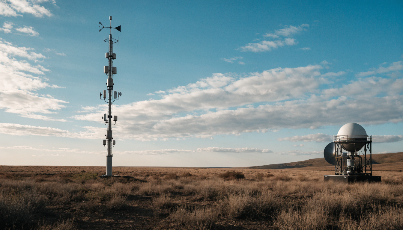
Key Takeaways
- Lidar, sodar and met masts all measure wind profiles but use different physical principles, giving each a different height range, accuracy and cost profile.
- Lidar uses an eye-safe 1.5 micron laser and Mie scattering to measure the Doppler shift of light reflected off aerosols, converting that shift directly into wind speed.
- Lidar typically achieves around ±0.1 m/s wind speed accuracy against sodar's ±0.5 m/s and a mast's ±0.3 m/s, while covering a taller height range.
- Global wind capacity reached roughly 93 GW of new installations in 2023, with levelized costs around $32/MWh, and modern 15+ MW turbines need wind profiles extending past 200 metres, which is pushing the industry toward remote sensing instruments.
Why Turbine Growth Has Outpaced Measurement Infrastructure
Wind turbines have grown substantially in the past decade, with hub heights and rotor diameters both increasing to capture more energy per installation. Machines rated above 15 MW now require an understanding of wind behaviour across a vertical span exceeding 200 metres, from the bottom of the rotor swept area to well above the hub. Traditional measurement infrastructure, largely built around fixed-height met masts, was not designed for this scale, which is why remote sensing instruments like lidar and sodar have moved from niche research tools into standard project practice.
How Lidar Measures Wind
Lidar wind profiling relies on Mie scattering, in which an eye-safe 1.5 micron laser beam is scattered by aerosol particles carried on the wind. The instrument measures the frequency shift, Δf, between the emitted and returned light, and calculates the radial wind velocity along the beam using the relationship v_radial = (Δf × λ) / (2 cos θ), where λ is the laser wavelength and θ is the beam's elevation angle from vertical. Most systems use pulsed coherent detection combined with a Velocity Azimuth Display, or VAD, scanning pattern, in which the beam sweeps a cone shape at a fixed elevation angle to reconstruct the full horizontal wind vector at each height.
How Sodar Measures Wind
Sodar, or sonic detection and ranging, uses the same Doppler principle but with sound waves instead of light. An acoustic pulse is transmitted upward and the frequency shift of sound scattered back by temperature and turbulence variations in the air is used to derive wind speed. Sodar typically covers a lower height range than lidar, in the region of 20 to 200 metres, and tends to have a coarser accuracy of around ±0.5 m/s, partly because acoustic returns are more sensitive to ambient noise and atmospheric stability.
Comparing the Three Technologies
| Parameter | Lidar | Sodar | Met Mast |
|---|---|---|---|
| Height coverage | 10 to 300 m | 20 to 200 m | Fixed instrument heights only |
| Wind speed accuracy | Around ±0.1 m/s | Around ±0.5 m/s | Around ±0.3 m/s |
| Operating temperature range | -40°C to +70°C | -10°C to +50°C | -30°C to +60°C |
Each technology has a role. A met mast still provides the simplest, most directly traceable point measurement at the heights it covers, but it cannot economically reach the top of a modern rotor. Sodar offers a lower-cost remote sensing option in benign environments but is more affected by ambient acoustic noise. Lidar generally offers the best combination of height range and accuracy for tall turbine assessment.
Performance in Difficult Conditions
Modern lidar units are built to keep working where older instruments struggle. Reported figures include turbulence detection down to a resolution of 0.1, terrain mapping at a 25 metre by 25 metre grid resolution for complex sites, and wind speed error held below 0.15 m/s even in Sea State 4 offshore conditions, where mast-based measurement is often impossible. Machine learning approaches, particularly LSTM-based models trained on lidar time series, have been reported to predict wind gusts with better than 92% accuracy, which is useful for both turbine load management and grid forecasting.
Standards and Safety Certification
Lidar systems used for wind energy assessment are increasingly built to align with IEC 61400-50-3, the standard covering ground-based remote sensing for wind measurement, and with DNV-ST-0437, a widely referenced standard for the design of wind turbines and their supporting measurement infrastructure. Eye safety is certified to Laser Class 1, meaning the beam is safe for wildlife and personnel under normal operating conditions. Many current units also support the D2W2 data format used in digital wind farm reporting across the EU, which simplifies integrating lidar data into project-wide monitoring systems.
Cost Efficiency at Scale
Across a full measurement campaign, the cost per data point from lidar has been reported to run around 83% lower than equivalent mast-based measurement once mast construction, certification and decommissioning are factored in. Combined with faster deployment and the ability to relocate a unit between sites, this is a major reason lidar has become the default remote sensing choice for utility-scale wind projects.
Choosing Between Lidar and Sodar
For projects requiring the tallest profiles and the best accuracy, lidar is generally the stronger choice. MetSensor UK supplies the VWL 3D scanning Doppler lidar for full wind field mapping and the ZAS Doppler sodar wind profiler as a lower-cost acoustic alternative for sites where its shorter range is sufficient. Both are described alongside our wider weather sensors range for teams comparing remote sensing options against conventional anemometry.
Summary
Lidar, sodar and met masts each measure wind by a different physical mechanism, and each has a place depending on turbine height, budget and site conditions. As turbines continue to grow past 200 metres in swept height, lidar's combination of range, accuracy and certification under IEC 61400-50-3 and DNV-ST-0437 has made it the leading choice for utility-scale wind energy assessment.
Frequently asked questions
What is the main difference between lidar and sodar for wind measurement?+
Lidar uses laser light and Mie scattering to measure wind, while sodar uses sound waves. Lidar generally covers a taller height range, around 10 to 300 metres against sodar's 20 to 200 metres, and offers finer accuracy.
Is wind lidar safe for wildlife and people nearby?+
Wind lidar units used for turbine assessment are typically certified to Laser Class 1, which means the beam is considered eye-safe for both personnel and wildlife under normal operating conditions.
What standards apply to lidar wind measurement for wind energy?+
IEC 61400-50-3 covers ground-based remote sensing devices for wind measurement, and DNV-ST-0437 is a widely referenced standard for wind turbine and measurement infrastructure design.
Why does turbine growth matter for wind measurement technology?+
As turbines pass 15 MW with rotor spans exceeding 200 metres, wind profiles need to extend well above what a conventional met mast can economically measure, which has pushed adoption of lidar and sodar.